Commercial Roof Zone Mapping.
Commercial Roof Zone Mapping support in New Orleans, LA, with documented inspections, written scopes, and practical roof planning for commercial properties.
What this roof work solves
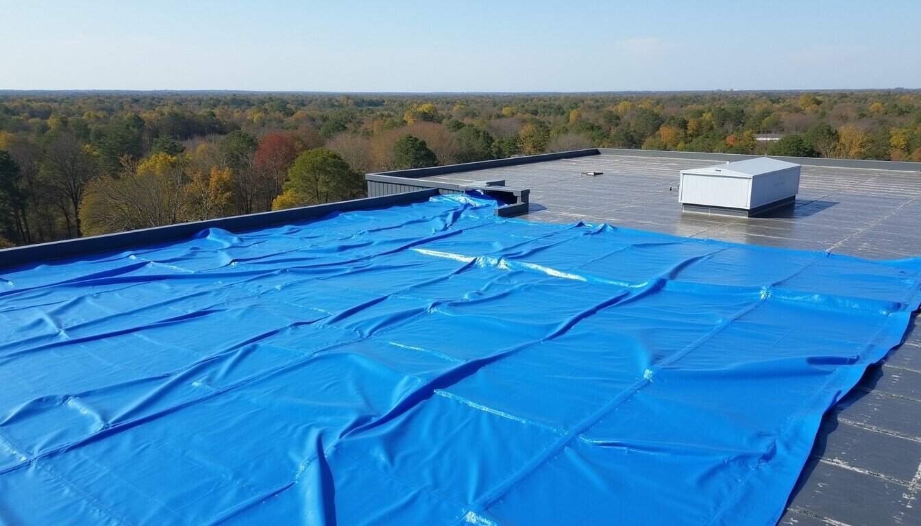
Commercial Roof Zone Mapping in New Orleans should begin with a documented roof walk. The first job is to identify active water entry, drainage problems, membrane condition, edge details, rooftop equipment conflicts, and weather exposure before a price or schedule is discussed.
For commercial owners, the useful answer is rarely a one-line recommendation. The roof file should explain the work area, the reason for the scope, the access constraints, and the next maintenance decision.
How the scope is built
The scope is tuned to owner documentation, building use, roof age, visible defects, and the cost difference between immediate repair and longer-range planning. When repair is enough, the work stays focused. When replacement or recover planning is the responsible move, the reasoning is written plainly.
Each finished project should leave behind before-and-after photos, service notes, and follow-up items so the owner keeps a record for future inspections, budgeting, and vendor conversations.
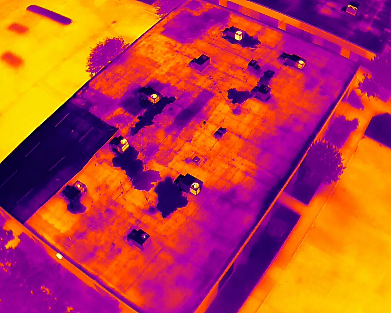
Every inspection report, post-storm condition assessment, moisture survey, and capital document we produce is anchored to a zone diagram specific to that building. In a market where storm events can move multiple buildings to emergency status simultaneously, the zone diagram is the reference that lets every stakeholder navigate the documentation without a contractor present to interpret it.
A photograph of a roof defect is not useful documentation if you cannot locate it on the roof. A post-storm damage report that says 'parapet flashing separation at east elevation' is not useful for an insurance adjuster assessing a claim on a building with 300 linear feet of east parapet in three distinct sections at three different heights. Zone diagrams solve this problem by creating a numbered reference system for every section of the roof that every subsequent report — inspection, moisture survey, post-storm assessment, warranty maintenance record — can anchor to the same coordinate.
Zone mapping is the first step on every building we add to our inspection program. Before the first inspection report, we produce a zone diagram keyed to the building's actual roof layout — its physical dimensions, drain and scupper locations, mechanical equipment positions, parapet geometry, expansion joints, and roof access points. The zones are numbered sequentially, sized to meaningful physical boundaries, and labeled with square footage per zone.
In the New Orleans market, the zone diagram has an additional function that it does not serve in markets without a storm season: it is the document that allows post-storm rapid assessment to be conducted systematically across a portfolio. When a building is assessed within 48 hours of storm passage, the field crew can walk each zone in the diagram sequence, photograph each zone against the same reference system used in the prior May inspection, and produce a post-storm condition update that is directly comparable to the pre-storm baseline — zone by zone, photo by photo. Without the zone diagram, that comparison is not possible.
How Zone Diagrams Are Built for New Orleans Buildings
We start with the building's roof plan if one exists — from the original permit set, from as-built drawings, or from the building's facility team records. For French Quarter and historic district buildings where original drawings may be incomplete or inconsistent with actual current configuration, we measure the roof geometry on-site and produce the diagram from field measurements. The diagram is drawn to scale with section areas labeled by square footage, drain and scupper locations marked, rooftop equipment positions noted, and parapet heights indicated where variable parapet height affects wind-uplift pressure calculations.
Zone numbering follows a consistent convention: north-to-south and west-to-east, numbered sequentially so that zone 1 is always the northwest-most section. Sub-zones within a main zone — the parapet return within zone 3, the drain detail within zone 3 — are designated with a letter suffix: zone 3A for the field membrane, 3B for the parapet return, 3C for the drain. This gives us a zone-level reference for field conditions and a sub-zone reference for specific details that require individual tracking across inspection cycles.
For New Orleans buildings with multiple roof levels — common in the pre-Katrina CBD office stock where mechanical penthouses and upper-level set-backs create multiple distinct roof sections — each level gets a separate zone diagram with a level prefix. Main roof zones are '1-' prefixed and penthouse or set-back zones are '2-' prefixed, preventing zone-number collisions across a complex footprint.
The Zone Diagram Through the Storm Cycle
The practical value of the zone diagram in the New Orleans market is most visible in the post-storm rapid assessment workflow. When a Category 3 storm moves through Orleans Parish and a portfolio owner needs to know the condition of 12 buildings within 72 hours of storm passage, the zone diagram is what allows systematic documentation rather than impressionistic observation. The field crew walks each building using the zone diagram, photographs each zone against the same reference system used in the May inspection, and produces a zone-by-zone post-storm update. The pre-storm condition for each zone is in the record. The post-storm condition is added to the same record. The delta is the storm-attributable change.
For buildings with active manufacturer warranties, this zone-keyed storm-comparison record is what supports the post-storm warranty claim. The manufacturer's field inspector arrives at the building, navigates the zone diagram, and reviews the pre-storm versus post-storm condition documentation zone by zone — without needing the building owner to reconstruct what the roof looked like before the storm or which sections were already deteriorating. That reconstruction is what takes weeks in the post-storm period when no pre-storm zone-keyed baseline exists.
Parapet and edge metal zones are maintained in the diagram with specific notation of the attachment detail type and the FM uplift rating documented in the project file for new installations. This detail allows the post-storm assessment to identify which parapet zones used pre-Katrina-code attachment details versus current hurricane-prone-region specifications — the difference that often determines which sections sustained storm damage and which held.
Permanence Through New Orleans Ownership Transitions
New Orleans commercial properties change hands. The post-Katrina period produced a wave of distressed-sale and redevelopment transactions that shifted ownership across the Orleans and Jefferson Parish commercial inventory at a high rate. The CBD has seen multiple rounds of office-tower ownership transitions as national REITs entered and exited the market. The French Quarter hospitality stock cycles through ownership as hotel brands and independent operators trade properties. Each ownership transition is an opportunity for the building's inspection and maintenance documentation to get lost — contractor files stay with the contractor, not with the deed.
Questions to settle early
Where is the risk?
Locate leaks, wet-insulation indicators, open seams, weak flashing, and drainage restrictions across the roof.
What can wait?
Separate immediate work from maintenance items that can be tracked for the next service window.
What should be funded?
Build a practical recommendation for repair, coating, recover, or replacement planning.
Need help with commercial roof zone mapping?
Send the building address, known roof age, access notes, and what changed. We will respond with the right next step.